Who handles yard grading in Waynesville, OH?
Shawn's Landscape handles yard grading in Waynesville, Warren County, Ohio. That covers Caesar Creek Village, Highland Hills, and Waynesville Historic District. Cost depends on lot size, how much the grade has to move, and access. Pricing comes from an on-site look, not a phone guess. Estimates are free. Call (513) 849-3279.
Why do Waynesville properties need engineered yard grading?
Waynesville sits inside Caesar Creek's flood plain, making drainage a year-round concern.
The Soil Challenge: Waynesville's upland soils are primarily Miamian silt loam over Wisconsinan glacial till, with Crosby silt loam occupying poorly drained depressions. The Miamian series averages 35 to 45 percent clay in the subsoil, while the Caesar Creek valley transitions to alluvial Genesee silt loam on the floodplain. Shallow limestone bedrock is present in some eastern portions of the watershed.
The Hydrology Reality: Caesar Creek is the dominant drainage feature, moderated upstream by an Army Corps of Engineers flood-control dam at Caesar Creek State Park. Despite the dam, the lower valley remains subject to seasonal saturation and backwater flooding. Properties within the Caesar Creek corridor carry FEMA Zone A floodplain designations. Because of these physical realities, generic landscaping solutions fail rapidly here. You need heavy equipment and technical engineering.
Learn more about our yard grading approach, pricing factors, and process. Or pick up the phone and describe what you're seeing.
COMMON SYMPTOMS WE FIX IN WAYNESVILLE
Water is pooling against my foundation every time it rains — what is wrong?
Your lot has negative grade: the ground slopes toward your house rather than away from it. Hydrostatic pressure builds against the foundation wall and will cause basement seepage or structural cracking if left uncorrected. We re-establish a minimum 6-inch drop over the first 10 feet from your foundation, permanently reversing this water path.
How do I fix low spots in my yard that hold standing water for days after rain?
Persistent low spots indicate clay settlement or erosion-caused depressions that have created a closed drainage basin with no outlet. We fill and compact with engineered topsoil blends, re-establish positive surface drainage, and eliminate the stagnant water that breeds mosquitoes and suffocates turf root systems.
My yard slopes toward my neighbor's property — am I legally responsible for their flooding?
Ohio courts have moved away from the "common enemy" doctrine toward civil liability for artificially concentrated surface water discharge. Grading that channels runoff onto an adjacent parcel can expose you to a civil suit. We ensure final grade directs all surface water to approved drainage outlets — not neighboring properties — and document the final elevations for your protection.
"The crew was professional, cleaned up after themselves, and the yard drains perfectly now. Shawn was honest about what we needed and what we didn't. That's rare."
Sarah M.
How do you avoid a bad yard grading contractor in Waynesville?
Major yard grading projects are intimidating. We eliminate the stress, hidden fees, and property damage associated with fly-by-night contractors.
- ✔ Site Protection Protocol We stake laser transit control points before any machine moves earth, stockpile topsoil separately from subsoil to preserve its organic layer, and deploy track mats on all access paths across your lawn.
- ✔ Transparent Pricing A laser transit elevation survey performed during the free estimate produces an exact cut-and-fill volume calculation. Your quote is derived from measured data — not visual guesswork — so there are no post-start discovery charges.
- ✔ Bureaucratic Shield For earth-disturbing projects over half an acre we handle all Warren County SWCD erosion and sediment control plan submissions so you remain compliant with NPDES regulations and avoid stop-work orders.
- ✔ Liability Coverage Final grades are documented and photographed to prove compliance with the positive-drainage requirement of the Warren County residential code, protecting you from neighbor liability disputes after project completion.
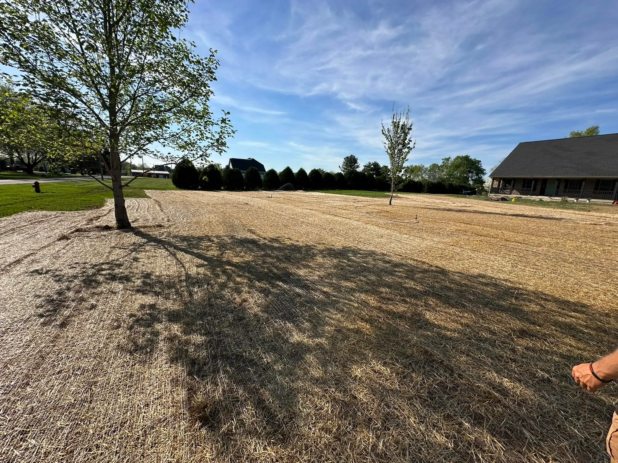
- ✔ Completion Guarantee Regrading is not complete until the disturbed area is seeded, an erosion-control straw blanket is applied, and a final elevation check confirms the design grade. We do not consider the job done until your turf is actively establishing.
WAYNESVILLE YARD GRADING FAQS
How much does yard grading cost in Waynesville?
Waynesville's upland soils are primarily Miamian silt loam over Wisconsinan glacial till, with Crosby silt loam occupying poorly drained depressions. The Miamian series averages 35 to 45 percent clay in the subsoil, while the Caesar Creek valley transitions to alluvial Genesee silt loam on the floodplain. Shallow limestone bedrock is present in some eastern portions of the watershed. Pricing comes off a laser topographical measurement taken during the free estimate, so there are no hidden fees. Call (513) 849-3279.
Will heavy equipment destroy my Waynesville lawn?
No. We utilize heavy-duty plywood track mats for all heavy machinery entering your property and guarantee to restore all turf and landscape features to their original state post-construction.
Are you licensed for earth-moving in Warren County?
Yes. Warren County SWCD administers Earth Disturbing Activity (EDA) permits for all unincorporated areas. Any project disturbing one acre or more additionally requires an Ohio EPA NPDES Construction General Permit regardless of county permit status. We handle all required SWCD erosion control submissions and building department permits so you are completely insulated from legal liability and fines.
Prefer to start online? Tell us about your yard grading project and we'll call you back with a straight answer.
REQUEST A FREE ESTIMATE ONLINE